Àptera se situe à une douzaine de kilomètres à l’est de Chania, en direction de Rethymnon. Un panneau vous indique le village de Megala Chorafia et le site archéologique d’ Aptera. La route est belle, d’un côté la vue sur la baie de Souda et de l’autre les oliveraies à perte de vue.

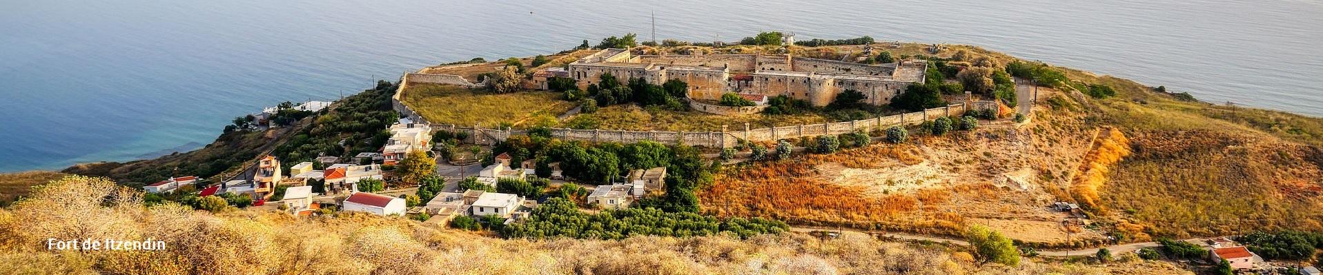
Our first stop is Itzendin Fort, with its splendid view over the bay. It was built by the Ottoman Turks in 1867 to quell Cretan rebellions. The Turks occupied the region from 1645 until 1897. That's 250 years!
It is one of the best-preserved Turkish forts, not only because it is the most recent, but also because it served the Greek state as a prison from 1948 until 1971. Although the exterior architecture has remained intact, the interior is well worth renovating, and renovation work is well underway. Visits to the interior are not yet permitted.
100 metres away, the fortress Koulés (fort in Turkish), also called Soumpasi, dominates the bay of Souda and the coast of Apokorona.
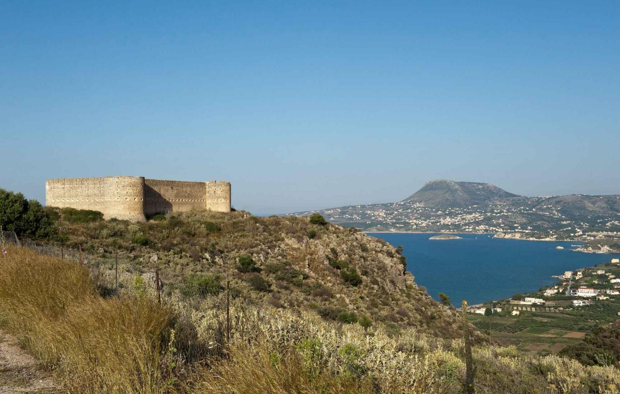
A relatively new Turkish fortress in good condition.
The fortress is in good condition, firstly because it is relatively recent (late 19th century) and the quality of its construction is excellent. And above all, because it has not been the scene of a disastrous battle.
The fortress was built to control the Apokoronas valley, through which the road to Chania passed. Together with the other forts built by the Turks in Apokoronas, it controlled the port of Souda and supported the nearby fortress of Itzendin.

Ce fort est située à 12 km à l’est de Chania, construit à la place d’un fort vénitien, tout près des ruines de l’ancienne cité Aptera. Il a été érigé par les Turcs après la révolution crétoise de 1866. Dans le but de reprendre le contrôle de la Crète grâce à un réseau de fortifications. Plus précisément, la construction a commencé en décembre 1867, s’est achevée en 1868. Elle constitue un exemple représentatif de l’architecture des forteresses du XIXe siècle.
After the departure of the Turks from Crete, this fort served as a school for the village of Megala Chorafia.
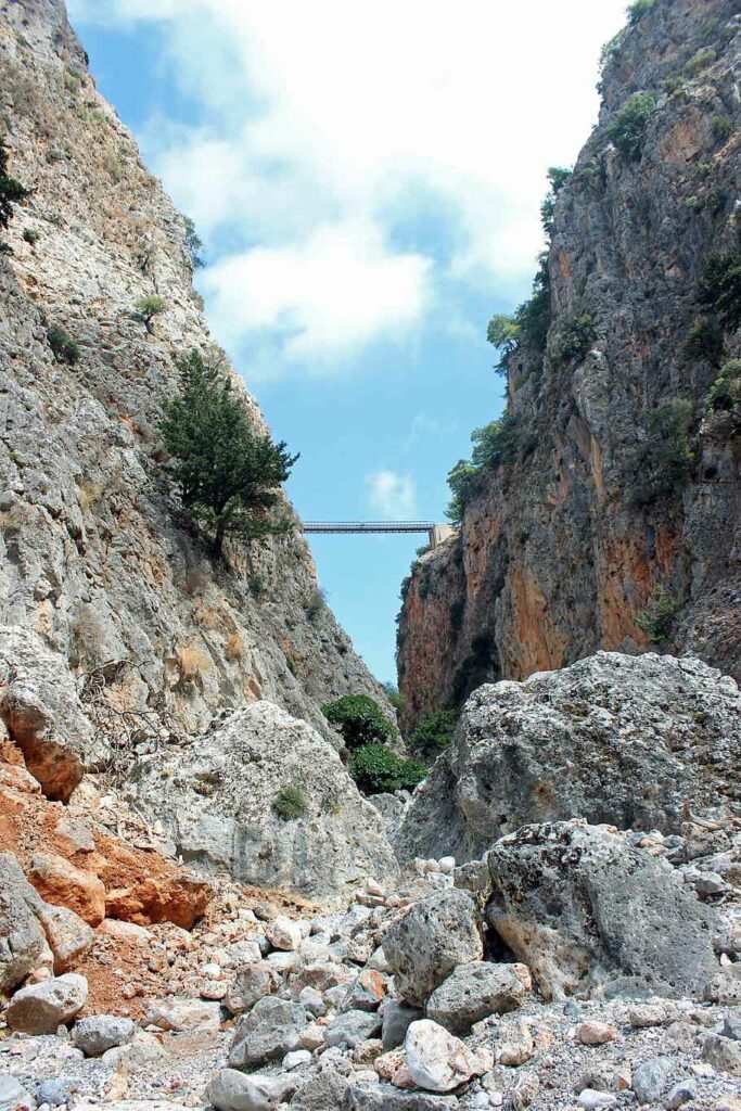
A short distance away is the site of the ancient city of Aptera. It's easy to see why the Dorian settlers chose this spot to build their city.

It was not only for the magnificent view but also to control the road and the surroundings. Built two hundred metres above the sea, on a steep hill, with the whole bay of Souda at its feet, this important city in western Crete had its heyday.
Founded around the eighteenth centuryth century BC and reached its peak in the Hellenistic period. Aptera's strategic position in the Bay of Souda gave it two ports: Minoa (now Marathi) and Kissamos (near present-day Kalyves).

A large part of the town wall, which once extended for around four kilometres, is still in good condition. These include two large vaulted cisterns dating back to Roman times. There are also the ruins of a theatre, the foundations of numerous houses and temples, and some vaulted tombs. Finally, there are the mosaic floors of several ancient Christian basilicas dating from the last period of the city's existence. At the centre of the archaeological site is a protected area, surrounded by a fence, where you can see the foundations of a small temple dating from the Classical period (5th century). There is also a Roman building with arcades, which probably housed the parliament. But most of the town, once full of ancient houses and streets, is now under the olive trees and surrounding fields.
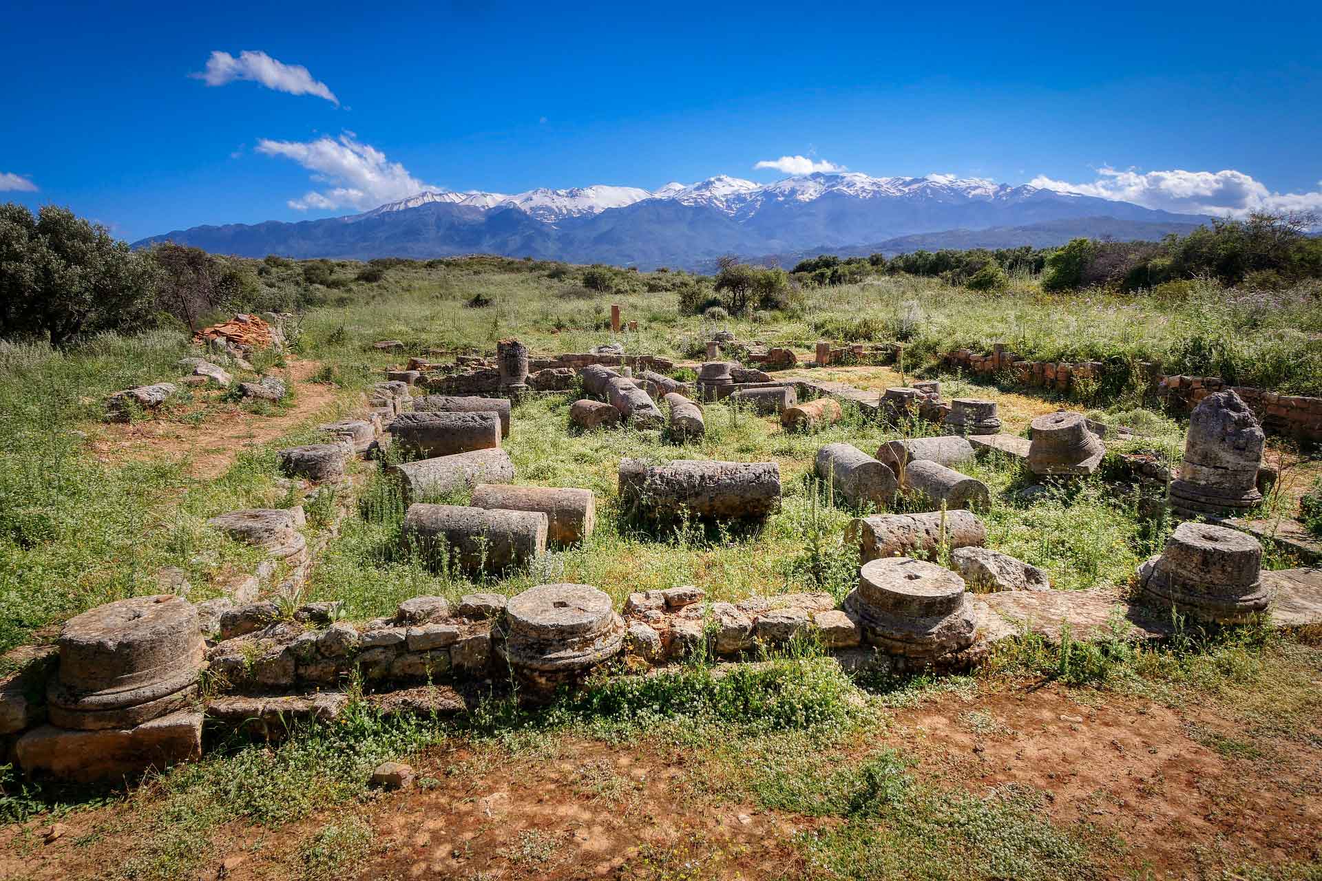
Their craftsmanship was renowned not only in Crete, but also on the Greek mainland and even in southern Italy. Their workshops produced the most beautiful masterpieces. They had their own fleet of ships, two harbours in the bay of Souda, and they developed a dynamic trade. The city flourished for a long period, during which no less than seventy-two different coins were minted!

Aptera continued to be an important city throughout the Roman period and into the early days of the Byzantine Empire. Before being destroyed by two earthquakes in the fourth and fifth centuries,th and VIIth , then by the Saracens in 823.
The Venetians then built a fort on the site of the ancient city. It was destroyed by pirates in 1583. The strategic position of the site was also exploited by the Ottomans, who built the fortress of Koules overlooking the entire bay of Souda, to the north of the site. It was also used by German troops, who positioned themselves on the plateau of the ancient city during the Second World War.
Robert Pashley the famous British explorer,th in the 19th century, the first to establish a link between the ruins discovered on the hill of Paliokastro and the city of Aptera, confirming this identification thanks to the coins found on the site. Archaeological excavations began in 1942. They were conducted by the Germans who occupied the island. Further excavations took place in 1986-1987 and 1992-1995. Excavations are still going on today. (for buses, see KTEL)