
INFORMATION
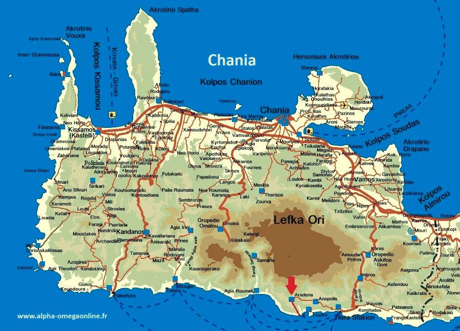
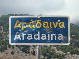
Start point: The hike in the Aradena Gorge begins in the abandoned village of Aradena, in the south of the Prefecture of Chania, in western Crete.
. GPS coordinates : N35.22249 – E24.06268 (downstream)
. Path marking: cairns and paint. Follow the riverbed downstream.
. Elevation gain: 650m
. Length: 4km
. Duration: From 3-4 hours depending on the rhythm chosen
. Difficulty: The route is hilly in places and a good physical condition is required. Within the reach of anyone who practices a minimum of sport.
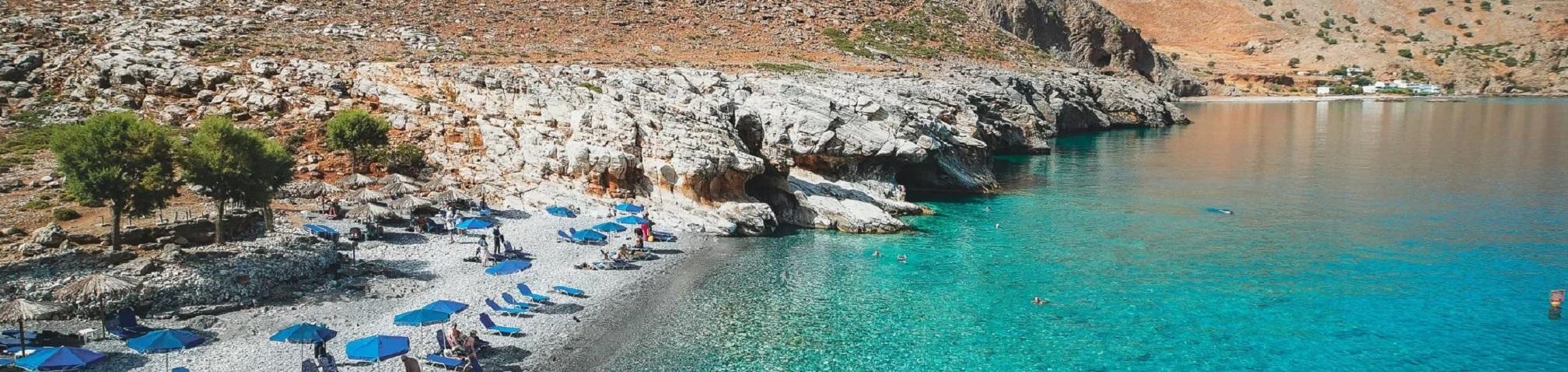
EquipmentYou will need: good shoes, a bottle of water, provisions for a small picnic, a hat, sun cream and a swimming costume for a well-deserved swim at the end of the gorge, at the beautiful Marmara cove.

Small restaurants are available thanks to the installation of a friendly local hut on the rock. The route in the gorges is rather shady. On the other hand, at the exit of the gorges and up to Loutro, there is a 1 hour walk, and, in summer, the sun... is shining. But there is the solution of the small taxiboat, which picks you up at the exit of the gorge, in Marmara, and transports you, fifteen minutes later, to Loutro. A very pleasant crossing. Then, from Loutro you take the boat which brings you back, 20min later, to Chora Sfakion. From there, either the last bus at 6.30 pm or a taxi, which you have already booked. And the circle is complete.
This very nice and wild Aradena hiking is still little travelled. Approximately 6 km from Aradena to Loutro, but only 4 km of gorge. The route is signposted, but a difficult ten-metre section used to be negotiated using a rope ladder. In the 2000s, a metal ladder made this tricky passage easier, but it was still impressive.
is still little frequented. About 6 km from Aradena to Loutro, but only 4 km of gorge. The hike is signposted, and a difficult passage of about ten metres used to be crossed by a rope ladder. In the 2000s, a metal ladder made this tricky passage easier, but it was still impressive. For the past ten years, a stony path has been laid out on the side of the mountain, with a wooden railing that is not always in good condition. At least the hike is becoming accessible to almost anyone with good footing who hikes. Finally, one should be careful of falling rocks, often caused by free-roaming goats, and especially not to engage in it outside the summer.
Access: The start of the hike is in Aradena, in the south of the Department of Chania
1. By bus
If you choose the public bus, don't forget to book your tickets on the website of the bus company "KTEL" (see the timetable KTEL).
From Chania to Chora Sfakion (1h40): In summer, there are 2 buses per day at 7am and 2pm. Price: €7.60. From Chora Sfakion there is a daily bus to Anopolis and Aradena, at 9am. So, by taking these two buses, and coming from Chania, you go directly to Aradena, at the entrance of the gorge.
From Chania to Chora Sfakion:In summer, there are 3 buses a day at 7am, 11am and 6.30pm. The latter waits, if necessary, for the passengers of the last boat, coming from Agia Roumeli and Loutro (those who have done the Samaria gorge and those from Aradena).
If you come from Rethymnon or Heraklion, you have to change buses in Vrysses (one bus per hour). But the journey is too long for this hike, which already takes a whole day from Chania alone.
2. By taxi
From Chania to the entrance of the Aradena Gorge it costs about 100€. You can use the local company sfakiataxi.gr
3. By rental car
If you choose to rent a car, leave early in the morning in the direction of Vryses, halfway between Chania and Rethymnon, then continue in the direction of Askifou and Chora Sfakion (also called Sfakia). Beautiful mountain road and after an hour you arrive at Chora Sfakion. From there, take the direction of Anopoli. Arrival half an hour later. Very nice winding road over the sea.

From there, take the direction of Anopoli. Arrive half an hour later. Very nice road winding over the sea. This traditional village offers the possibility to rent rooms. 2 km away, the village of Aradena, the last village on the road, was abandoned in the 1960s after a but recently some old houses have been renovated to revive this beautiful site. At the entrance of the village, you cross the
At the entrance to the village, you cross the ’ Bailey bridge of Aradena, a gift from a wealthy Greek to open up the nearby village of Agios Ioannis, has a deck made of large, slightly spaced wooden beams. This Bailey Bridge, donated by a wealthy Greek to open up the nearby village of Agios Ioannis, has a deck, made of large wooden beams spaced slightly apart and when driving across it, the noise and the 138m depth cause some sweating.
This bridge is suitable for bungee jumping. In the summer, and during the weekends, if you have the heart, you can taste the pleasure of Aradena bungee jumping. (voir website)

From the bridge and the side of the white chapel of Michaïl ArchangellosAt the top of the bridge, you can see the beautiful mule track that links the two sides of the gorge. Until the bridge was built in 1986, this path (kalderimi) was the only way to link the two sides of the canyon. Take the path through the village, and after 200m begin the descent.
This hike is a real pleasure, but beware of landslides and rockfalls on 200m-high copper walls. Nature is very beautiful, there are still very few tourists, and I wonder whether I should continue to publish this page...
From Marmara, if you choose to walk in the direction of Loutro, with the sun at its zenith, you will pass a few restaurants on the seafront, in the area of Lykos. Otherwise, a little further on, there is a good restaurant in Phinikas (Finix) which offers local products, vegetables, fish and especially lamb, which is delicious. All that remains is to reach Loutro, after a half hour walk. There is a beautiful view and the ruins of a Venetian castle overlooking the sea.

Arrival in Loutro (see our page), touristy but peaceful and picturesque village, before 5.30 p.m. in summer, to catch the last boat (See Loutro boat timetable) which provides a link between the ports in the south of the Department, taking you to Chora Sfakion after 20 minutes. With a taxi that you have booked in advance, drive back up to the entrance to the Aradena Gorge to collect your car.
The ideal solution, the one I prefer, is to organise this excursion with several people in two cars. In the morning, when arriving at Chora Sfakion, leave one of them there, and with the second one, and all the hikers of the group, go up to Aradena (about 20 km) and leave it there, at the entrance of the gorges.
At the end of the afternoon, after crossing the gorge and taking the boat, you return to Chora Sfakion. There, you pick up the first car left in the morning, and you go back to Aradena to pick up the second one. A little gymnastics but it allows you to be independent from other means of transport and to control the time. map of Chania).
The article's editor: Papadogeorgakis Nikos / Degeorges Nicolas